Overview

- Location: Tyrol, Austria; 46.83°N, 10.83°E
- Website: https://www.lter-austria.at/rofental; https://www.uibk.ac.at/projects/station-hintereis-opal-data/index.html.en
- Operational Management: University of Innsbruck, Austria; Bavarian Academy of Sciences, Germany; Hydrographic Service of Tyrol, Austria
- Purpose/Scientific Focus: The data and research undertaken at the sites of investigation in the Rofental area enable combined research of cryospheric, atmospheric and hydrological processes in complex terrain, and support the development of several state-of-the-art glacier mass balance and hydroclimatological models. The institutions taking part in the Rofental research framework promote their site in several international research initiatives.
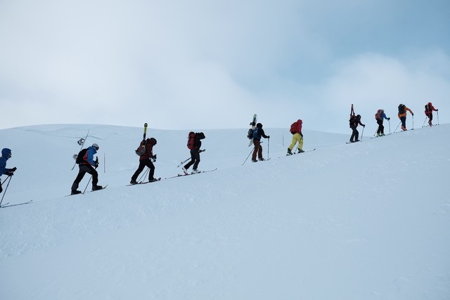
The data sets span a period of 150 years and hence represent a unique time series of high-altitude mountain observations. Their collection was originally initiated to support scientific investigation of the glaciers Hintereisferner, Kesselwandferner and Vernagtferner. Annual mass balance, glacier front variation, flow velocities and photographic records of the status of these glaciers were recorded. Later, additional measurements of meteorological and hydrological variables were undertaken, and over time a number of autonomous weather stations and runoff gauges were brought into operation; the available data now comprise records of temperature, relative humidity, short- and longwave radiation, wind speed and direction, air pressure, precipitation, and river water levels. Since 2001, a series of distributed (airborne and terrestrial) laser scans is available, along with associated digital surface models. From 2013 onwards special climate and snow stations were installed to measure additional snow variables at three high-elevation sites. In 2016 a permanent terrestrial laser scanner was installed on Im hintern Eis (3244 m a.s.l.) to continuously observe almost the entire area of Hintereisferner.
Characteristics

- Location (Physiographic Region): The Rofental is a catchment in the central eastern Alps, namely in the upper Ötztal Alps (Tyrol, Austria). About a quarter of its area (still) is ice-covered. The valley floor is a narrow discontinuous riparian zone typically less than 100 m in width. The Rofental stretches from 1891 m a.s.l. at the gauge at Vent, the lowest point of the catchment, to 3772 m a.s.l. at the summit of Wildspitze, the highest summit of Tyrol. The average slope is 25° and the average elevation is 2930 m a.s.l.. The Rofenache is a tributary to the Venter Ache, Ötztaler Ache and the Inn and as such contributes to the Danube system (i.e., the Black Sea).
- Area: 98.1 km2
- Elevation: Mean 2930 m a.s.l., Min 1891 m a.s.l. to Max. 3772 m a.s.l.
- Description (Physical–Ecological–Climatic Characteristics): The climate of the Rofental is characterized as an inner Alpine dry type. The mean annual temperature at the station in Vent (1900 m a.s.l., 46.85833° N, 10.91250° E) is 2.5°C, and total annual precipitation varies between 797 mm in Vent (1982–2003) and > 1500 mm in the higher altitudes around 3000 m a.s.l., confirmed by the recordings at various totalisators. In these higher regions, seasonal snow cover lasts from October until the end of June.
- Drainage/River System: The Rofenache is a tributary to the Venter Ache, Ötztaler Ache and the Inn and as such contributes to the Danube system (i.e., the Black Sea). The river gauge at Vent (1891 m a.s.l., 46.85694° N, 10.82361° E) has been operated continuously from the Hydrographic Service of Tyrol since 1967. The characteristic water discharges (m3/s, 1971–2013) are NQ = 0.09 (lowest discharge), MQ = 4.6 (mean discharge) and HQ = 109 (highest discharge); further characteristic data are published as annual review in the “Hydrographisches Jahrbuch von Österreich” (http://bmlfuw.gv.at, data download at http://ehyd.gv.at). The runoff regime of the Rofenache is not modified by any measures of hydropower generation and is dominated by the melt of snow and ice during spring and summer, respectively. The early melt season onset is typically in April. The gauge at Vernagtbach (2635 m a.s.l.) has been operationally maintained by the Bavarian Academy of Sciences and Humanities since 1973 and is the highest streamflow recording site in Austria with measurements also documented at http://ehyd.gv.at since 2003. The Vernagtbach catchment stretches from 2635 m a.s.l. at the gauge to 3635 m a.s.l. at the summit of Hinterer Brochkogel. According to the glacier inventory of 2006 (https://doi.org/10.1594/PANGAEA.844985), the ice coverage of the Vernagtbach at that time was 71%. The current rapid decrease of the glaciated area in the Rofental is documented in the WGMS database (http://wgms.ch).
- Site History/Historical Context: See https://doi.org/10.5194/essd-10-151-2018
- Glacierized Area (% and year(s) measured): Still about 25%, annual mass balances reported to WGMS
- Main Land Cover(s): Land cover in the Rofental is dominated by mountain pastures and coniferous forests in the lower areas, but these only cover little of the area (source: “Land Tirol”, http://data.tirol.gv.at). Permafrost is likely to occur at north-facing slopes at higher altitudes.
- Lithology/Soils: The geological bedrock in the Rofental area mainly consists of biotite-plagioclase, biotite and muscovite gneisses, variable mica schists, and gneissic schists of the Austroalpine Ötztal nappe. Subordinate lithologies are quartzites and graphite schists. Granitic gneisses, amphibolites and diabase occur as layers ranging from a few meters to a few hundred meters thick within the metasedimentary sequence.
- Mean Annual Temperature: 2.5 °C at gauge
- Mean Total Annual Precipitation: 800 to >1500 mm
- Snow Characteristics: deep, cold
- Years of Data: Since 1889 (map “Der Vernagtferner im Jahre 1889 1 : 10 000”, constructed by means of terrestrial photogrammetry (Finsterwalder, 1897)
Stations & Observations
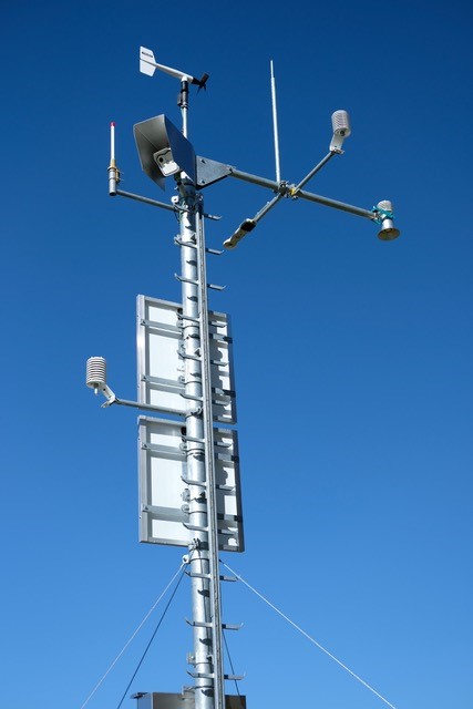
Observational Stations and Sites
| Type | Station Name | Latitude | Longitude | Elevation | Notes/Details |
| Climate and Snow Station | Bella Vista | 46.78284°N | 10.79138°E | 2805 m | Data since July 2015 or September 2017 |
| Climate and Snow Station | Latschbloder | 46.80106°N | 10.80659°E | 2919 m | Data since September 2013 or September 2017 |
| Climate and Snow Station | Proviantdepot | 46.82951°N | 10.82407°E | 2737 m | Data since October 2019 |
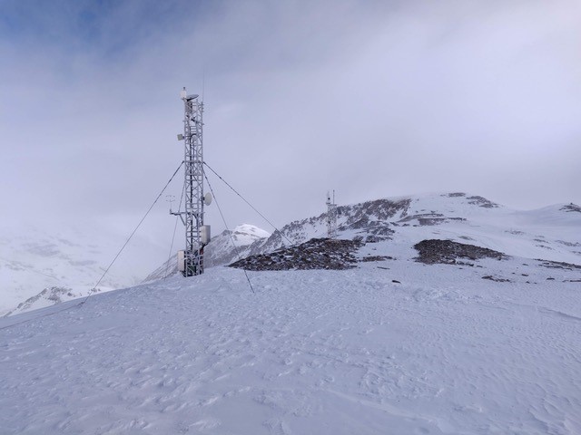
| Terrestrial Laser Scanner | Im Hintern Eis | 46.79586°N | 10.78277°E | 3244 m | Since 2016 |
| Meteorological | Hintereisferner | 46.79867°N | 10.76042°E | 3026 m | Since 2010 |
| Hydrometric | Vent | 46.85722°N | 10.91083° E | 1891 m | |
| Hydrometric | Vernagtbach | 46.85675°N | 10.82886°E | 2635 m | |
|
Notes See https://doi.org/10.5194/essd-2017-85 and https://doi.org/10.5194/essd-2021-68 for a detailed description of all stations/sensors available and the respective data repositories. |
|||||
Field Observation Campaigns and Other Measurements
| Measurement | Instrument Description | Spatial/Temporal Resolution and Coverage | Notes/Details |
| Terrestrial Laser Scanner | Riegl VZ-6000 TLS | within 0.1 m of coincident high-accuracy ALS data for approx. 80 % of the surface of HJF | at 3244 m a.s.l. close to the summit Im hintern Eis (46.79586◦ N, 10.78277◦ E) |
| UAV Sensors | Campaigns | ||
| Time-lapse Photographs | Im Hintern Eis, Bella Vista | ||
| Snow Pits/Snow Surveys | Campaigns | ||
| Glacier Surface Elevation | Hintereis | ||
| Glacier Mass Balance | Vernagtferner, Hintereisferner, Kesselwandferner at WGMS | ||
|
Notes See https://doi.org/10.1594/PANGAEA.876120 and https://doi.org/10.5194/essd-2021-68 |
|||

Data Availability
Geospatial Data
| Elevation | Many DEMs available, see https://doi.org/10.5194/essd-10-151-2018 |
| Landcover and Soils | Land cover in the Rofental is dominated by mountain pastures and coniferous forests in the lower areas, but these only cover little of the area (source: “Land Tirol”, http://data.tirol.gv.at). Permafrost is likely to occur at north-facing slopes at higher altitudes. |
| Stream/River Network | To be derived from DEM |
| Basin Delineation/Shapefile | To be derived from DEM. Kml-file available |
Observational Data Availability
- Publication: https://doi.org/10.5194/essd-10-151-2018
- Data: https://doi.org/10.1594/PANGAEA.876120 and https://doi.org/10.5194/essd-2021-68 (update in preparation)
Modelling Activities
Dept. of Geography, Univ. of Innsbruck: openAMUNDSEN; https://github.com/openamundsen/openamundsen, https://doc.openamundsen.org
Contact & Further Information
Strasser, U., Warscher, M., Rottler, E. and Hanzer, F. (2024): openAMUNDSEN v 0.8.3: an open source snow-hydrological model for mountain regions, EGUsphere [preprint], https://doi.org/10.5194/egusphere-2024-193.
Warscher, M., Marke, T., Rottler, E. and Strasser, U. (2024): Operational and experimental snow observation systems in the upper Rofental: data from 2017 to 2023, Earth Syst. Sci. Data Discuss. EGUsphere [preprint], https://doi.org/10.5194/essd-2024-45.
Hanzer, F., Förster, K., Nemec, J. and Strasser, U. (2018): Projected hydrological and cryospheric impacts of 21st century climate change in the Ötztal Alps (Austria) simulated using a physically based approach, Hydrol. Earth Syst. Sci., 22, 1593-1614, https://dx.doi.org/10.5194/hess-22-1593-2018.
Hanzer, F., Helfricht, K., Marke, T. and Strasser, U. (2016): Multi-level spatiotemporal validation of snow/ice mass balance and runoff modeling in glacierized catchments, The Cryosphere, 10, 1859-1881, https://doi.org/10.5194/tc-10-1859-2016.
Contacts- Dr. Ulrich Strasser; ulrich.strasser@uibk.ac.at
- Dr. Lindsey Nicholson; lindsey.nicholson@uibk.ac.at