
Overview of COPE
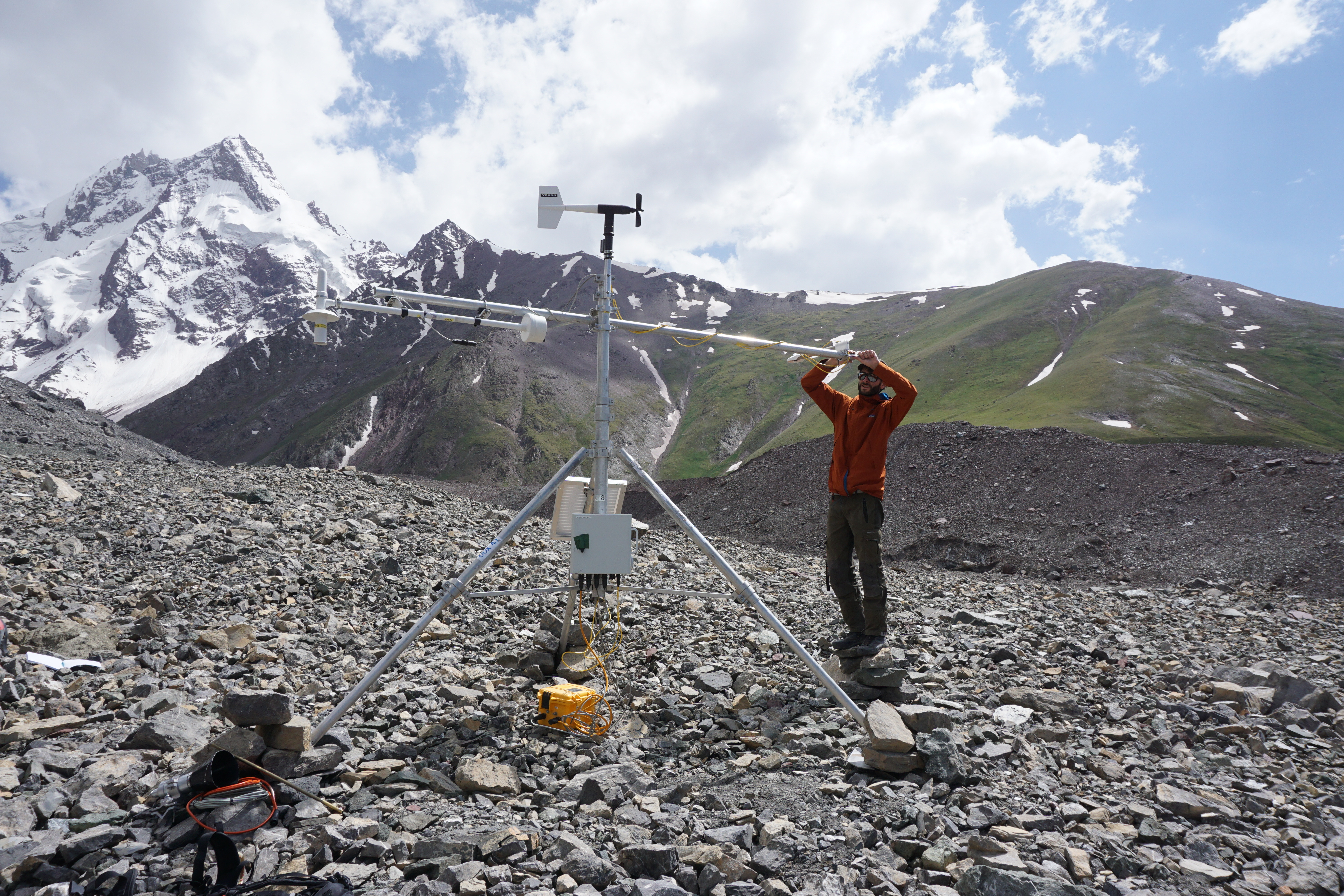
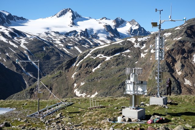
INARCH conducted a Common Observing Period Experiment (COPE) over the period 2022–2024 as a focal network activity to collect high-quality measurements along with supplementary observations and remote sensing campaigns. The aim was to produce a common, coherent, and well-documented and described dataset of mountain meteorology and hydrology from INARCH basins over the two-year period at a minimum, and longer where possible.
The next phase of this initiative involves diagnostic evaluations of hydrological, glaciological, and atmospheric models using COPE data. Models are being applied to examine the impact of different forcing data, process representations, and model structures, and thereby gain insight into why models produce various behaviours and to see if models benchmark various known aspects and regimes of the coupled atmospheric-cryospheric-hydrological system. Model evaluations emphasize atmospheric, snow, glacier, and water processes in high mountain terrain and include sparse forest, non-needleleaf vegetation, glaciated, and alpine windblown sites.
This initiative will produce a valuable and unique set of observations, model simulations and diagnostic evaluations, new process understanding and insights, and better prediction of the changing mountain water cycle in the headwaters of many of the world’s major river basins.
COPE steering committee
Coordination and support: •Stephen O’Hearn, •Chris DeBeer
Data, Observational Products, COPE outputs
- Tibetan Plateau
- Ma, Y., Xie, Z., Chen, Y., Liu, S., Che, T., Xu, Z., Shang, L., He, X., Meng, X., Ma, W., Xu, B., Zhao, H., Wang, J., Wu, G., Li, X. (2023). Spatially extensive long-term quality-assured land-atmosphere interactions dataset over the Tibetan Plateau. National Tibetan Plateau / Third Pole Environment Data Center. https://doi.org/10.11888/Atmos.tpdc.300977.
- Rofental, Ötztal Alps, Austria
- Department of Geography, University of Innsbruck (2024): Continuous meteorological and snow hydrological measurements for 2013-2023 from three automatic weather stations (AWS) in the upper Rofental, Ötztal Alps, Austria. GFZ Data Services. https://doi.org/10.5880/fidgeo.2023.037.
- Dischma region in Switzerland
- Magnusson, J., Jonas, T., Bühler, Y., Webster, C., Mazzotti, G. (2024). A high-resolution snow and hydrometeorological dataset for the Dischma region in Switzerland. EnviDat. https://www.doi.org/10.16904/envidat.568.
- Northwestern Pamirs
- Dataset - Snowfall decrease in recent years undermines glacier health and meltwater resources in the Northwestern Pamirs, https://doi.org/10.5281/zenodo.14287504
- Jouberton, A., Shaw, T.E., Miles, E. et al. Snowfall decrease in recent years undermines glacier health and meltwater resources in the Northwestern Pamirs. Commun Earth Environ 6, 691 (2025). https://doi.org/10.1038/s43247-025-02611-8
- Sentinel-2 snow products for all INARCH basins
- Gascoin, S. (2025): Sentinel-2 snow products, https://sgascoin.github.io/INARCH/
Modelling outputs and projections:
- Schmidtt, P., Nicholson, L., Prinz, Rainer (2025). OGGM standard projections aggregated for 10 INARCH basins, https://zenodo.org/records/17018026
Modelling & other COPE science activities
A variety of models are being run for diagnostic evaluations using COPE observations from INARCH basins. These include:
- Cold Regions Hydrological Model (CRHM), https://research-groups.usask.ca/hydrology/modelling/crhm.php
- openAMUNDSEN (distributed snow/ice/hydrological model), https://doc.openamundsen.org
- OGGM (open global glacier model), https://oggm.org
- Cosipy, https://cryo-tools.org/tools/cosipy/
- WRF\NoaaMP\CLM\LES models
- FSM2 (can be run stand-alone or within CHM), https://github.com/RichardEssery/FSM2
- Thethys-Chloris, https://doi.org/10.1029/2011MS000086
- SPHY, https://gmd.copernicus.org/articles/8/2009/2015/
- AMelt, https://doi.org/10.3390/geosciences11020078
- SNOWPACK/Alpine3D, https://meteoio.slf.ch/; https://snowpack.slf.ch/; https://alpine3d.slf.ch/
- SnowModel, https://journals.ametsoc.org/view/journals/hydr/7/6/jhm548_1.xml
- Canadian Hydrological Model (CHM; https://github.com/Chrismarsh/CHM)
- AWSM/iSnobal, https://github.com/USDA-ARS-NWRC/awsm
- FSM-OSHD
- S3M, https://gmd.copernicus.org/articles/15/4853/2022/gmd-15-4853-2022.html
- TopoPyScale, https://gmd.copernicus.org/articles/7/387/2014/gmd-7-387-2014.html / https://github.com/ArcticSnow/TopoPyScale
- SURFEX-Crocus, https://doi.org/10.5194/gmd-5-773-2012 / http://www.umr-cnrm.fr/spip.php?article265
- SnowMet, https://doi.org/10.1016/j.jhydrol.2009.03.021
Other planned analyses include comparison of the responses and sensitivity of COPE basins to temperature and precipitation changes, comparing trends and change points in basin cryosphere and hydrology, and comparing ecological changes occurring (e.g., treeline, shrubs, wildfire) and their impacts on basin hydrology.
To manage COPE data and basin metadata across the network, we are using the custom-developed GWFNet Catalogue, which is a high-level information hub specialized for easily relating together different forms of records on water science research.