Overview
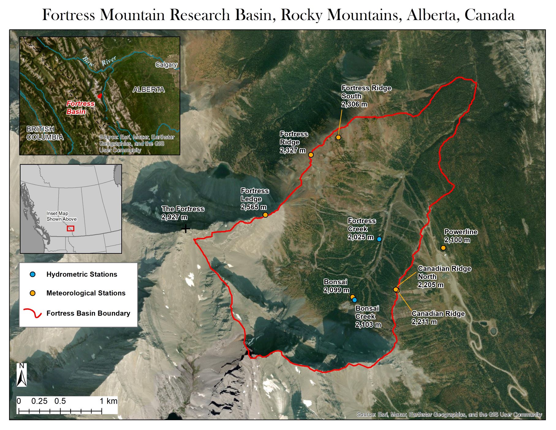
- Location: Alberta, Canada; 50.83°N, 115.22°W
- Website: https://research-groups.usask.ca/hydrology/science/research-facilities/crho.php
- Operational Management: Centre for Hydrology, University of Saskatchewan
- Purpose/Scientific Focus: This site was established for snow and weather monitoring in the Rocky Mountain Front Ranges. It has multiple stations for measuring the accumulation and melt of snow in great detail on mountain ridgetops, subalpine forests and in deep drift locations, as well as streamflow gauges. There are studies on groundwater and alpine wetlands, forest–snow interactions, storms over the continental divide, blowing snow, and snow remote sensing with drones and lidar systems.
Characteristics
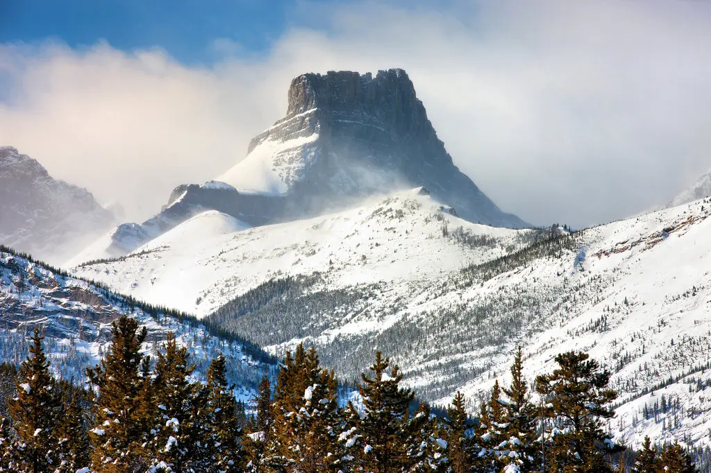
- Location (Physiographic Region): Situated in the Kananaskis Range of the Canadian Rocky Mountain Front Ranges.
- Area: 5.92 km2
- Elevation: 1,786 – 2,832 m
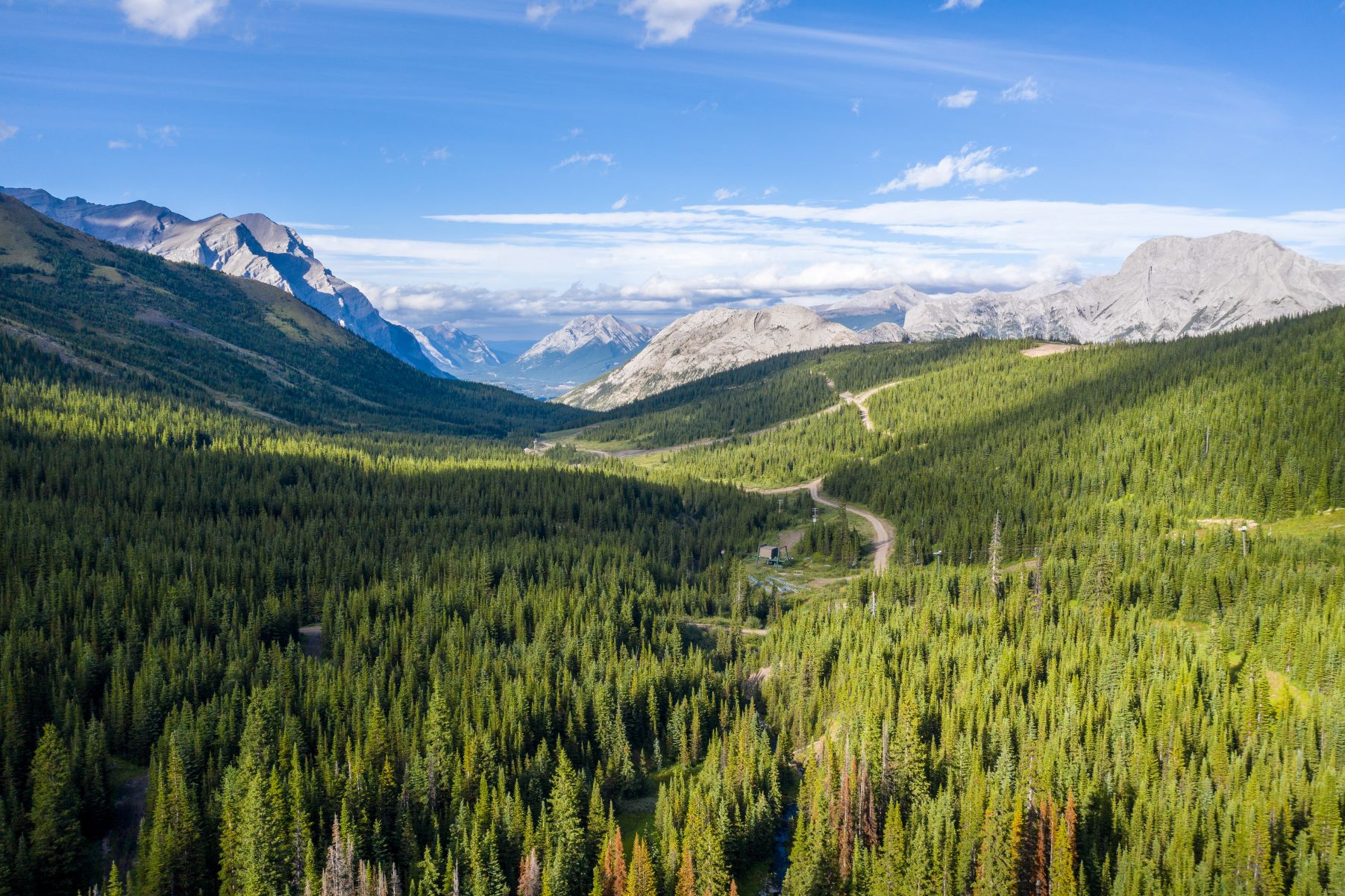
- Description (Physical–Ecological–Climatic Characteristics): The basin contains complex terrain with steep slopes and high cliffs. Climate is highly seasonal with variability due to winter Chinooks and summer snowfalls, but typically has long cold winters and cool wet summers falling in the humid continental category. Forest cover consists mainly of subalpine fir (Abies lasiocarpa), and Engelmann spruce (Picea engelmannii).
- Drainage/River System: Drainage is to the Bow River via the Kananaskis River, part of the South Saskatchewan River system.
- Site History/Historical Context: A ski resort was in operation here since the 1960s but closed in 2007, although a cat skiing operation has continued. Beginning in 2013-14 the site was instrumented with seven snow and weather monitoring stations. The site has more snowfall than other lower elevation parts of the Kananaskis Valley. It is surrounded by, but outside of the boundaries of provincial parks and recreation areas, it has an access road to high elevations, access to facilities and power supply, and support and safety personnel on site. Over the last decade it has been an active site for hydrological research and instrument testing.
- Main Land Cover(s): Mainly forest and alpine meadows; upper parts of the basin (less than 20% area) are alpine, with rock and talus.
- Lithology/Soils: Limestone and shale. The surface geology is predominantly well drained glacial till consequent of the most recent glaciation, overlaying fractured bedrock with varying thickness.
- Mean Annual Temperature: −2.2°C (2565 m), 0.04°C (2100 m)
- Mean Total Annual Precipitation: 1052 mm (2100 m)
- Snow Characteristics: Cold, deep, and highly redistributed snow by wind and avalanching in open areas.
- Years of Data: Data are avaialble since 2014
Stations & Observations
Observational Stations and Sites
| Type | Station Name | Latitude | Longitude | Elevation | Notes/Details |
| Meteorological | Powerline | 50.82598 | -115.1982 | 2,100 m | Download list of sensors |
| Meteorological | Canadian Ridge | 50.8215 | -115.2063 |
2,211 m |
Download list of sensors |
| Meteorological | Canadian Ridge North | 50.8216 | -115.2065 | 2,205 m | Download list of sensors |
| Meteorological | Bonsai | 50.82092 | -115.21391 | 2,099 m | Download list of sensors |
| Meteorological | Fortress Ledge | 50.83004 | -115.22851 | 2,565 m | Download list of sensors |
| Meteorological | Fortress Ridge | 50.83642 | -115.22049 | 2,327 m | Download list of sensors |
| Meteorological | Fortress Ridge South | 50.83823 | -115.2157 | 2,306 m | Download list of sensors |
| Hydrometric | Fortress Creek staff stream gauge | 50.82710 | -115.20912 | 2025 m | Automatic pressure level logger recording, seasonal staff stream gauging, estimated streamflow discharge based on rating curves |
| Hydrometric | Bonsai Creek staff stream gauge | 50.82057 | -115.21360 | 2103 m | Automatic pressure level logger recording, seasonal staff stream gauging, estimated streamflow discharge based on rating curves |
Field Observation Campaigns and Other Measurements
| Measurement | Instrument Description | Spatial/Temporal Resolution and Coverage | Notes/Details |
| Terrestrial Laser Scanner | 2013-2014 field season | ||
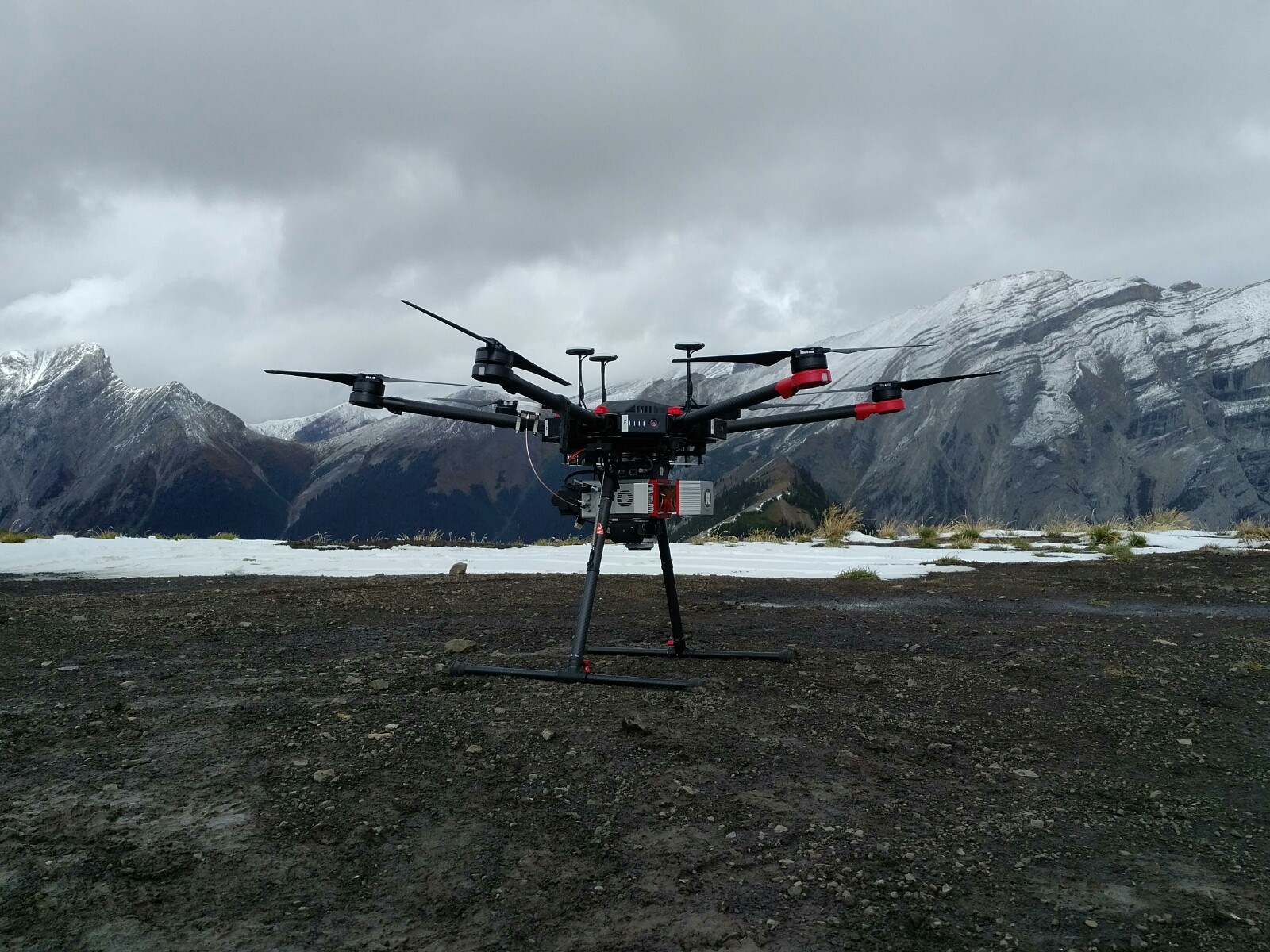
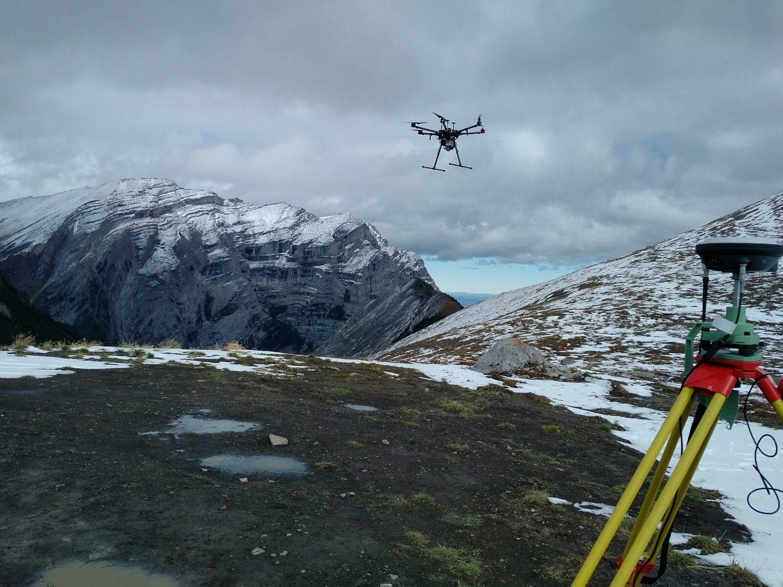
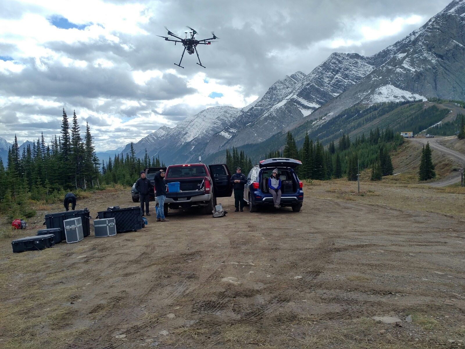
| UAV Sensors | AltaX with lidar/thermal/RGB/multispectral | Every 2-4 weeks during winter | |
| Snow Pits/Snow Surveys | several manual snow survey transects located in and above alpine treeline, in subalpine forest and forest clearings |
Data Availability
Geospatial Data
| Elevation | 2 m lidar and higher resolution from UAV-lidar for <2500 masl |
| Landcover and Soils | Alberta Landsat-derived land cover (ABMI), with updates from site visits, UAV-lidar point cloud (canopy height model and other derivatives) |
| Stream/River Network | Stream network delineated from Topaz GIS analysis using 2 m Lidar DEM |
| Basin Delineation/Shapefile | Basin delineation from Topaz GIS analysis using 2 m Lidar DEM |
Observational Data Availability
- Near real time data can be found at https://research-groups.usask.ca/hydrology/data.php
Modelling Activities

Hydrometeorological data measured from stations have been gone through Quality Control (QC) procedures. The missing gaps in the QC data have been infilled using various interpolation techniques (i.e. spatial station regression and temporal averaging interpolation). The gap-infilled QC data have been used to create forcing data for hydrological modelling. The hydrological models are tested against SWE observed from snow surveys and streamflow discharge measured at stream gauges. The purpose of model testing is to identify inadequacy in the model and improve processes representation in cold regions hydrology. The developed hydrological model can be used as tool to evaluate hydrological impacts of climate change and forest disturbance. In addition, hydrological models have been used for evaluating accuracy of alternative model forcings such as model outputs from GEM 2.5 KM high resolution or bias corrected WRF-GEM-CaPa 10 KM model outputs, which is quite useful by utilizing high quality hydrometeorological data measured from stations. This can be applied to future study when outputs from the advanced atmospheric models become available.
Contact & Further Information
-
How a former ski hill in southern Alberta has become an important key to climate study, https://www.cbc.ca/news/canada/calgary/coldwater-lab-centre-for-hydrology-canmore-alberta-university-of-saskatchewan-1.6705804, CBC News, Jan 9, 2023
-
Moving up, Moving Green: Long-term mountain systems monitoring with a local tourism operator, Global Water Futures Story Sprints feature article, 2023.
-
Langs, L. E., Petrone, R. M., & Pomeroy, J. W. (2021). Subalpine forest water use behaviour and evapotranspiration during two hydrologically contrasting growing seasons in the Canadian Rockies. Hydrological Processes, 35(5), e14158. https://doi.org/10.1002/hyp.14158
- Schirmer, M., & Pomeroy, J. W. (2020). Processes governing snow ablation in alpine terrain–detailed measurements from the Canadian Rockies. Hydrology and Earth System Sciences, 24(1), 143-157. https://doi.org/10.5194/hess-24-143-2020
- Dr. John Pomeroy, Centre for Hydrology, University of Saskatchewan (john.pomeroy@usask.ca)